
Why go
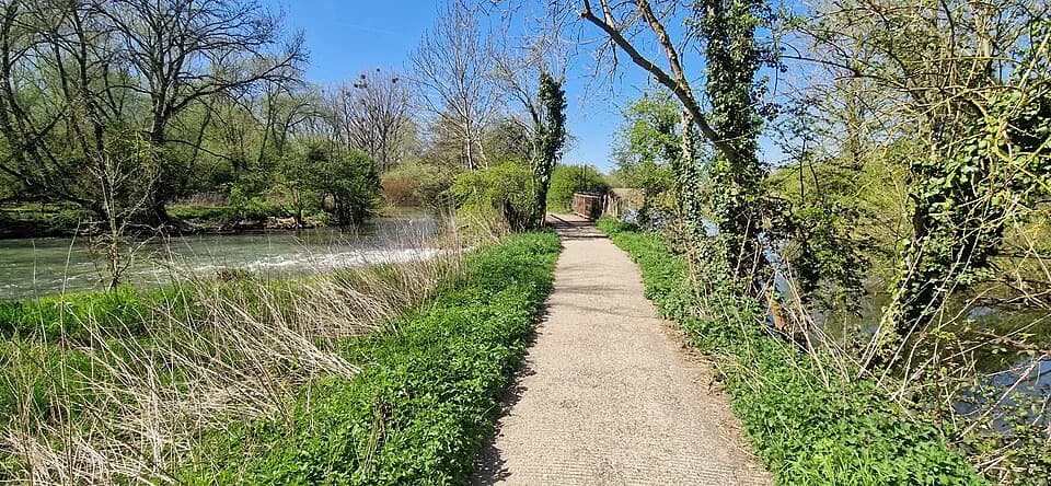
When accessible, the path traces an unusual piece of Oxford's river landscape: land enclosed by the upper and lower Cherwell channels rather than an ordinary park lawn. Its name means ‘between rivers’, and the route towards Kings Mill recalls the area's former use of river power. It should not be planned as a current walking stop while the closure remains in place.
What to look for
- The narrow land lies between the upper and lower channels of the Cherwell.
- The path runs towards Kings Mill, a site with a long history of water-powered milling.
The full story
Mesopotamia is a slim spur of land within University Parks, set between upper and lower branches of the River Cherwell. Its name borrows a Greek term meaning ‘between rivers’. The university acquired the land during the Parks' nineteenth-century expansion, and Mesopotamia Walk was laid out along the spur in 1865 towards Kings Mill. A watermill was recorded at that site in the Domesday Book, and milling continued there for centuries. One of the river levels served as the mill stream, so the split channels have a practical history as well as a scenic one. The narrow path later gained a footbridge in place of a ferry that had crossed from its midpoint. These layers explain why the route is distinctive, though the present maintenance closure means it belongs in the park's context rather than a current walking plan.
Useful to know
- The path is closed for maintenance; check the University Parks notice for reopening before planning a route.
- Do not use Mesopotamia Walk as a through-route while the closure remains in place.
Your next visit
Estimated · Declared scenario and planning estimates; no live opening, weather, queue or booking service.
Outdoor visit · 30–45 min
World planning estimate; admission, opening, visit duration and access need checking.