
Why go
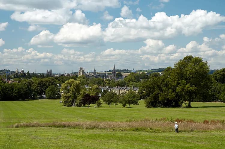
South Park's chief draw is the change in perspective: from its higher ground, Oxford's historic towers read together across the skyline. The open space also offers room for a longer stroll, while the park's link to St Clement's makes it a natural eastward extension from the centre.
What to look for
- The upper slope opens a broad view towards Oxford's historic centre.
- A nineteenth-century bridge connects the area with Headington Hill Park.
- The carved stone near the foot of the park records its preservation as public space.
The full story
South Park was once part of the Morrell family's land around Headington Hill Hall. The Oxford Preservation Trust bought it in 1932 to keep the hillside as open space, then gave the land to the city in 1951. A carved stone at the lower edge records that transfer. Those dates matter when looking west from the park: the view of Oxford's skyline depends on this slope remaining open rather than being built over. Headington Road runs alongside the park, while St Clement's leads back towards the centre and a nineteenth-century bridge links to Headington Hill Park. Together these connections make the park more than a viewpoint reached by car. It can form part of a walk out from the city, with the ascent gradually revealing the towers that are hard to see as a single group from the narrow central streets.
Useful to know
- Climb towards the higher ground for the city view; the slope is part of the visit.
- Use St Clement's as the link between the park and central Oxford.
- Expect an exposed outdoor walk and dress for the weather.
Your next visit
Estimated · Declared scenario and planning estimates; no live opening, weather, queue or booking service.
Outdoor visit · 30–45 min
World planning estimate; admission, opening, visit duration and access need checking.