
Why go
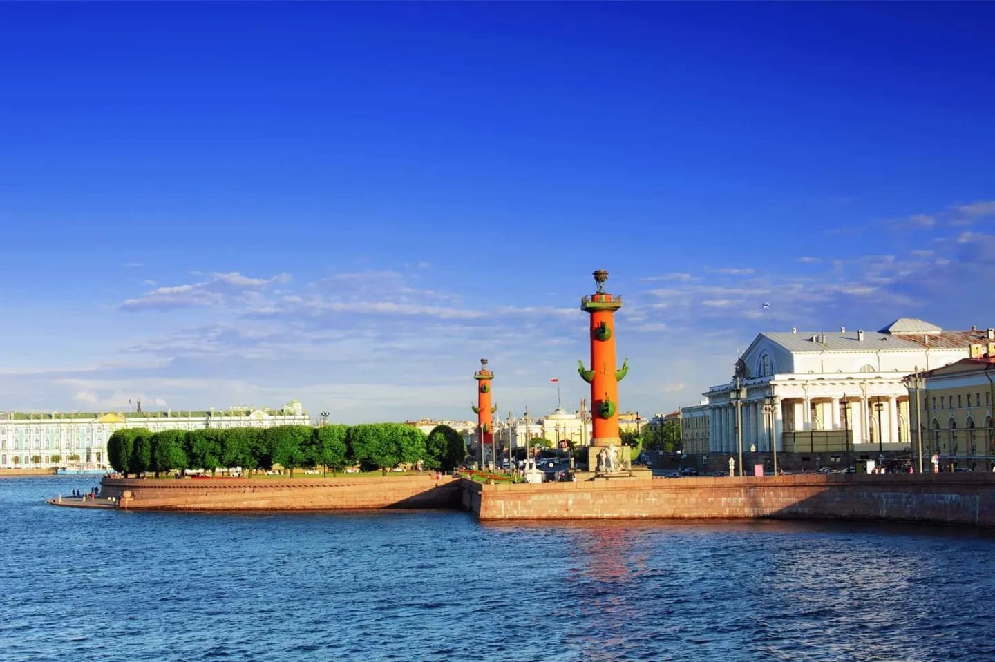
Vasilievsky Island rewards attention to scale, orientation, and setting. Vasilievsky Island is an island in Saint Petersburg, bordered by the rivers Bolshaya Neva and Malaya Neva (in the delta of Neva) from South and Northeast, and by the Gulf of Finland from the West. Before leaving, compare one close detail of Vasilievsky Island with its broadest public view.
What to look for
- Vasilievsky Island: Read the main silhouette against the open space around it.
- Vasilievsky Island: Look closely at facade materials and ornament.
- Vasilievsky Island: Step back to place the landmark in the skyline.
The full story
Vasilievsky Island is an island in Saint Petersburg, bordered by the rivers Bolshaya Neva and Malaya Neva (in the delta of Neva) from South and Northeast, and by the Gulf of Finland from the West. Vasilievsky Island is separated from Dekabristov Island by the Smolenka River. Together they form the territory of Vasileostrovsky District, an administrative subdivision of Saint Petersburg. Situated just across the river from the Winter Palace, it constitutes a large portion of the city's historic center. Two of the most famous St Petersburg bridges, Palace Bridge and Blagoveshchensky Bridge, connect it with the mainland to the south. The Exchange Bridge and Tuchkov Bridge across Malaya Neva connect it with Petrogradsky Island. Vasilievsky Island is served by the Vasileostrovskaya station of Saint Petersburg Metro. Geographically, the island consists of two main parts. The south and east of the island are old, with buildings mostly from the 19th century.
Useful to know
- Walk Vasilievsky Island in daylight, then compare its outline with the Rostral Columns.
Your next visit
Estimated · Declared scenario and planning estimates; no live opening, weather, queue or booking service.
Outdoor visit · 30–45 min
World planning estimate; admission, opening, visit duration and access need checking.